Welcome to TheOhioOutdoors
Wanting to join the rest of our members? Login or sign up today!
Login / Join

Corner-crossing hunters claim ‘shared airspace’ in trespassing defense.

CJD3

Dignitary Member
Supporting Member
14,778
215
NE Ohio
I found this an interesting read. Although I usually I side with landowners, this was a new issue to consider.
--------------------------------

Defendants in a multi-million-dollar trespass lawsuit maintained under questioning that the airspace they traversed while corner crossing to hunt on public land is shared with the public and is not the exclusive domain of the ranch owner who is suing them.

Four Missouri hunters targeted by Elk Mountain ranch owner Fred Eshelman told their stories in depositions filed April 12 in federal court in Casper. In dozens of pages, they answered questions posed by Eshelman’s attorney.

“I didn’t cross through any private airspace,” said hunter Bradly Cape, the owner of a Missouri fence-building company whose work requires frequent interaction with property lines and land ownership issues. “It’s a common shared airspace. I know I never crossed private airspace.”

Cape, Phillip Yeomans, John Slowensky and Zachary Smith described in their testimony how they corner crossed in Carbon County to hunt public land adjacent to Elk Mountain Ranch without setting foot on private land. Corner crossing involves stepping from one section of public land to another at the common corners with two sections of private property — all arranged in a checkerboard pattern of land ownership — without touching the private land.

An attorney for Eshelman, a wealthy North Carolina pharmaceutical magnate, questioned the four earlier this year in Cheyenne regarding their 2020 and 2021 hunts on Elk Mountain.

Eshelman contends his company, Iron Bar Holdings, has property rights at Elk Mountain that extend above the ground and that the corner-crossing men trespassed even though they did not touch his land. He filed papers from real estate agents saying if corner crossing were allowed, agents would devalue his 22,045-acre ranch by between $7.7 and $9.4 million.

No legislation, lawsuit or criminal case has firmly established the legality of corner crossing. As a result, Eshelman, a hunter himself, can have near exclusive control over access to thousands of acres of public land enmeshed in his Carbon County ranch if corner crossers are kept at bay.

Across the West, some 8.3 million acres of public land are inaccessibly “corner-locked” if the public can’t reach them by corner crossing, so the federal civil suit has widespread implications.


Corner-crossing hunters claim ‘shared airspace’ in trespassing defense (msn.com)
 
Last edited:

CJD3

Dignitary Member
Supporting Member
14,778
215
NE Ohio

The 1878 corner

Some of the Missourians discovered during a 2019 antelope hunt nearby that the Elk Mountain property surrounded thousands of acres of public land, according to an interview Cape and Yeomans gave to Steven Rinella on Rinella’s MeatEater hunting podcast broadcast June 20, 2022. They began thinking about returning for an elk.

After researching whether they could be charged for trespassing while corner crossing, Cape, Yeomans and Smith returned in 2020 to give it a shot. They figured they could cross corners to reach and hunt on some of the thousands of acres of public land on wildlife-rich Elk Mountain — state and federal property that would be inaccessible without corner crossing or the grace of Eshelman. The hunters never called the ranch for permission to hunt on public land, according to the depositions.


Surveyor L. M. Lampton’s field notes from 1878 describes how he set a notched granite monument “18x10x9” at the common corners of four mile-by-mile sections — the site at the center of the corner-crossing lawsuit. (Government Land Office records)
Surveyor L. M. Lampton’s field notes from 1878 describes how he set a notched granite monument “18x10x9” at the common corners of four mile-by-mile sections — the site at the center of the corner-crossing lawsuit. (Government Land Office records)© Provided by WyoFile
They camped initially on a section of public land administered by the Bureau of Land Management that is accessible by county road. From there, the Missourians easily found the first corner they wanted to cross — a few hundred yards from their camp.

“It’s got two big [no trespassing] signs sticking up there you can see,” Cape said while answering a question from Eshelman attorney Greg Weisz. “There is a U.S. Geological Survey marker there, T-posts, chain, wire tying the two T-post together, a lock.”

The monument marked the point shared among the two public and two private parcels and indicated the layout of the property boundaries.

Surveyor L. M. Lampton and his crew set that corner on Aug. 27, 1878 as part of the federal Public Land Survey System. They reached what would become the corners of sections 13, 14, 23 and 24, Township 20 North, Range 82 West, by measuring from a known point a mile to the south.

At the corner the surveyors dug a foot-deep hole where they set a marked, granite cuboid about the size of two shoeboxes, according to Lampton’s field notes. A resurvey decades later replaced the cuboid with a monument made of a metal pipe capped with a disc marked with the numbers of the four sections and indicating which is located in what quadrant.

Armed with the information, the hunters were poised to step over the marker, from one piece of public land to another piece of public land, without ever setting foot on Eshelman’s private property. But there was an obstacle.
 

CJD3

Dignitary Member
Supporting Member
14,778
215
NE Ohio

Enter the ladder

At the first common corner, a ranch worker had driven a T-post into each of the two kitty-corner Elk Mountain Ranch sections close to the monument. Each post had a no-trespassing sign.
“I can’t step between the signs because of the chain and the lock,” Cape said of his first crossing in 2020. “So I … plant my left foot on the public land, grab the T-post, swing my right foot around and hit the public land on the other side.”
As part of their defense, the hunters assert that the federal Unlawful Inclosures Act of 1885 bars private landowners from fencing off access to public lands. Eshelman asserts that his property rights include the airspace above his land and that anybody passing through it is trespassing.

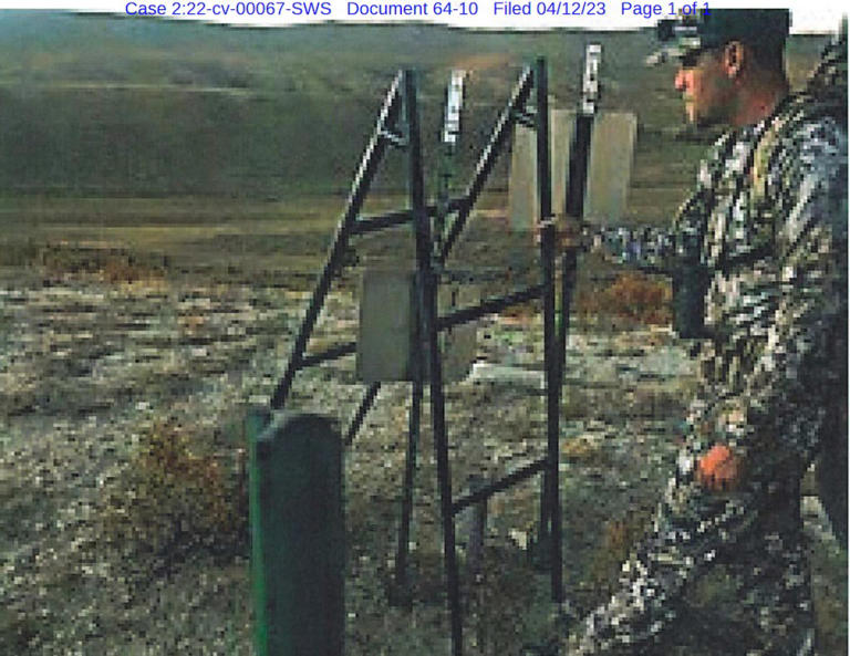
Zach Smith holds the ladder used to surmount fence posts to reach public land adjacent to Elk Mountain Ranch in this exhibit filed in the trespassing lawsuit. (Exhibit/U.S. District Court)
Zach Smith holds the ladder used to surmount fence posts to reach public land adjacent to Elk Mountain Ranch in this exhibit filed in the trespassing lawsuit. (Exhibit/U.S. District Court)© Provided by WyoFile
Yeomans and Smith said in 2020 they crossed the corner in the same manner as Cape. Beyond that point, the men navigated using the onX mapping app on a cell phone which uses GPS to pinpoint the users’ location on a map overlaid with land ownership information. With that tool they approached and found subsequent common corners, according to court documents, before stepping over them.
By finding and relying on the monuments, instead of onX exclusively, the hunters avoided the potential problem of the GPS technology’s imprecision.
No other corner the hunters crossed had T-posts erected on the private parcels similar to the obstacle at the intersection where the hunters first crossed.
On their hunt in 2020, the men killed three elk — one five-point and two six-points. They field dressed and packed out their kills using the same navigation scheme, according to their depositions.
During that 2020 hunt, Elk Mountain Ranch property manager Steve Grende encountered the men and accused them of trespassing, the hunters said. “Mr. Grende claimed that, because these Defendants grabbed Plaintiff’s obstruction at the First Corner, they had trespassed on private land,” hunters stated in court papers.
Grabbing the ranch T-posts “was a contention brought up by [ranch property manager] Steve Grende in our first encounter with him,” Yeomans said in a deposition. The obstructing T-posts’ connection to private land made them legally radioactive.
The hunters decided they needed an alternative method if they wanted to return.
“So tell me about the ladder,” Weisz asked Cape during last month’s deposition in Cheyenne.

To cross the T-post-blocked corner in 2021, fence-maker Cape fashioned pieces of steel fence pipe into a step ladder. The hunters brought it to Wyoming, Cape said, “so we didn’t have to touch the T-post.”
Yeomans explained further. “The ladder was used to remove any doubt, any suspicion of any wrongdoing, to protect the landowner’s property, signs and T-post.”
The hunters didn’t take the ladder farther up the mountain, instead laying it down near the first corner “so it couldn’t be seen,” Cape said. “I didn’t want anybody to steal my ladder.”
The hunters claim Grende harassed them while they hunted on public land and his calls to law enforcement led Game and Fish to call the Missourians off the mountain. That cut their hunting excursion short, the Missourians said, before they filled all of their licenses in 2021. Neither Game and Fish nor the U.S. attorney for Wyoming has filed hunter harassment charges against anybody from Elk Mountain Ranch.
 

CJD3

Dignitary Member
Supporting Member
14,778
215
NE Ohio

‘Ownership of space’

The hunters have referenced Wyoming law that states “[t]he ownership of the space above … is … vested in the several owners of the surface beneath.” That position produced dizzying exchanges regarding theories of property rights and airspace, including this one between attorney Weisz and Cape.

Weisz: Do you agree that you pass through the airspace above the surface of the Iron Bar private property?

Cape: No.

Weisz: You crossed through that space regardless of who owns that airspace?

Cape: Did I cross through airspace?

Weisz: Yes sir.

Cape: Yeah, I assume I’m in airspace.

Weisz: Do you agree with me that above the surface is airspace?

Cape: Yes.

Weisz: I’m not asking you who owns it or whether you had a right but you physically crossed through that airspace, right?

Cape: Through air.

And this exchange between Weisz and Yeomans:

Weisz: Did your body pass through the airspace above the surface of the Iron Bar private property?

Yeomans: I understand that airspace to be common and shared. So I stayed within shared airspace.

Weisz: Did any part of your body touch the airspace located above the private property?

Yeomans: I understand that my shoulders are wider than a brass cap [surveyor’s monument marking the common corner], but I did not exit public property or the shared corner.”

And this exchange between the attorney and Smith:

Weisz: Did you cross through the airspace located above the surface of Iron Bar private property?

Smith: I don’t think I did because I never left public air space.

Weisz: Is that your contention that the airspace above the Iron Bar property — that that airspace is public property?

Smith: No, sir.

Weisz: Is it possible to cross through this corner without crossing through the airspace located above the Iron Bar private property surface?

Smith: I believe to enter something, you must have to leave something, and I never left public airspace.

Cape described the difference between Eshelman’s airspace and that occupied by Cape’s own house in Missouri this way: “One’s construction, one’s not.”

Weisz and the hunters did, however, establish some common ground.

Weisz to Cape: You agree with me that the legal question of whether you had a right to [pass through airspace above Iron Bar property] is one of the things we’re going to answer in this case, right?

Cape: I agree to that, yes.

Weisz to Smith: A portion of your body had to physically cross through the airspace located above the Iron Bar deeded property. Do you agree with that?

Smith: I agree.

Weisz: Whether you had a right to do so is subject to dispute in this litigation.

Smith: Yes.

Weisz to Slowensky: The airspace physically located above the Iron Bar property, your body pass[ed] through that?

Slowensky: Yes.

Not looking for a fight

On Rinella’s podcast, the hunters said they weren’t looking for a precedent-setting confrontation, just a hunt. After they were ticketed in 2021, they sought the help of the Wyoming chapter of Backcountry Hunters and Anglers, which launched a GoFundMe campaign to ensure they could have their day in court.


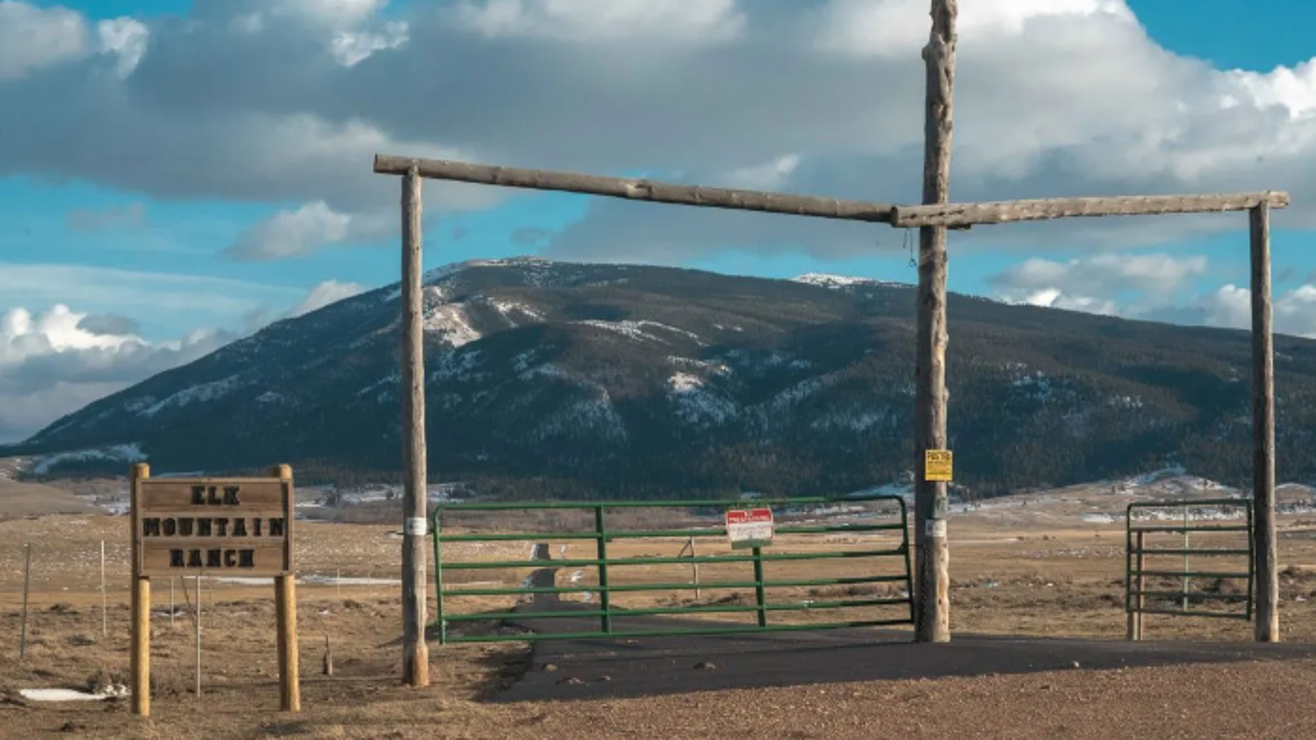
Signs on Elk Mountain Ranch property mark the survey monument at the common corner with two sections of public land. (Mike Vanata/WyoFile)
Signs on Elk Mountain Ranch property mark the survey monument at the common corner with two sections of public land. (Mike Vanata/WyoFile)© Provided by WyoFile
“Backcountry Hunters and Anglers did not instigate this,” Buzz Hettick, chairman of the Wyoming chapter said at a forum in Laramie earlier this month. “I knew none of those hunters until they brought this case to us.”

As of Monday, the campaign had raised $116,964.

A Carbon County jury last year found the four not guilty of criminal trespass and trespassing to hunt in a separate case in state court. As Eshelman’s civil case advances in federal court, both sides have asked the judge to rule at least partly in their favor without a trial.

The hunters want the suit dismissed; Eshelman wants the judge to rule that the men trespassed and for a jury to decide only damages.

The post Corner-crossing hunters claim ‘shared airspace’ in trespassing defense appeared first on WyoFile.
 

mike hunt

Junior Member
380
61
The property owner was probably fucked with by some asshole and had enough, not saying the owner isn't an asshole, but there's 2 sides to everything. Iv'e had fishermen give me shit while standing on my property, that didn't last long.
 

Bigcountry40

Member
4,730
127
The property owner was probably fucked with by some asshole and had enough, not saying the owner isn't an asshole, but there's 2 sides to everything. Iv'e had fishermen give me shit while standing on my property, that didn't last long.
Actually it was the opposite, ultra rich ass hole had the public land to himself and wanted to keep it that way for his outfitter. SimilR situation happen quite a bit on streams out west with fisherman fishing on boats and rich ass holes claiming they own the water. It’s high water mark, by no means am I condoning your issue with trespassers
 

Clay Showalter

Southern member northern landowner
6,773
145
Guilford County
I have mixed feelings on this issue, I understand getting access to public tracks of lands, but I am not sure I would want people crossing my property at the corner. Especially if I owned two of the corners, if there were four tracts involved.
 

brock ratcliff

Dignitary Member
Supporting Member
25,126
261
Pffft…. I think it would be a great idea to clearly mark a 30’ path/road between the two tracts of public land to provide access. Call it a right of way, whatever. There is no good reason for folks to have to use a ladder to get access to public ground from public ground. “Owning” ground is such a ridiculous concept in reality. How the heck does a man own the earth he will be buried in. Owning ground does nothing but guarantee you the right to pay taxes on it and have some say in who will utilize it…. Unless of course the govt determines to implement eminent domain and build a road. Unreasonable landowners like this clown should suffer the inconvenience of a brand new road connecting the two public parcels.